Quang Ngai is a province in the South Central Coast region of Vietnam, on the coast of East Sea. It had a population of 1,631,697 in 2021. It is located 883 kilometres (549 mi) south of Hanoi and 838 kilometres (521 mi) north of Ho Cha Minh City. The province has been historically populated with H're people and ethnic Kinh, and located on the coast.
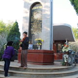
Mộ Cụ Huỳnh Thúc Kháng, or the Tomb of Huỳnh Thúc Kháng, is a significant historical site located on Thiên Ấn Mountain in Sơn Tịnh District, Quảng Ngãi, Vietnam. This tomb honors Huỳnh Thúc Kháng, a prominent figure in Vietnam's history, particularly known for his contributions to the country's struggle for independence and his role in the early government of the Democratic Republic of Vietnam.
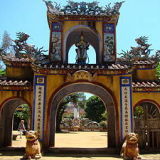
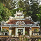
Chùa Thiên Ấn is one of the most famous Buddhist temples in Quang Ngai province, Vietnam. Located on Thien An Mountain in Son Tinh district, the pagoda offers a blend of spiritual significance and natural beauty. From the pagoda, visitors can admire the spectacular panoramic views of the surrounding countryside, including the Tra Khuc River, rice fields, and the distant sea. The scenery is particularly impressive at sunrise and sunset.
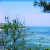
Đảo Lý Sơn, also known as Cù Lao Ré, is a small island located in Quảng Ngãi Province, central Vietnam. It is about 30 kilometers off the coast of Quảng Ngãi and is famous for its beautiful landscapes, historical significance, and cultural heritage.
Mũi Ba Làng An, also known as Batangan Peninsula, is a prominent cape located in Quảng Ngãi Province, Vietnam. It is known for its rugged natural beauty, historical significance, and its role as a geographical landmark along Vietnam’s central coastline. The name "Ba Làng An" translates to "Three Villages of An," reflecting the historical settlement of three An villages in the area.
Đặc khu Lý Sơn is the remaining remnant of a volcano with five craters, formed approximately 25-30 million years ago. These five volcanoes are the main source of groundwater, supplying water to all the island's inhabitants. The population in 2025 is 25,639 people.
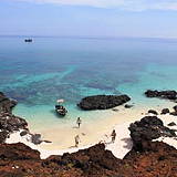
Cù Lao Bờ Bãi, also known as Đảo Bé or đảo An Bình, is a small island located in Quảng Ngãi Province, Vietnam. It is characterized by its pristine beaches, clear waters, and lush vegetation. The island offers a peaceful and serene environment, making it a great spot for those looking to escape the hustle and bustle of city life.
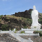
Chùa Đục is a significant Buddhist temple located on Lý Sơn Island in Quảng Ngãi Province, Vietnam. Chùa Đục is situated on the slope of Giếng Tiền Mountain, one of the five volcanic mountains on Lý Sơn Island. The pagoda is nestled in a serene natural setting, offering visitors a peaceful environment with scenic views of the surrounding landscape and the sea.
Núi Thới Lới is the highest peak on Lý Sơn Island, located in Quảng Ngãi, Vietnam. It is a prominent feature of the island, known for its geological significance, breathtaking views, and its role in the island's natural and cultural landscape. The mountain’s structure includes volcanic craters, basalt cliffs, and layers of lava rock, making it a fascinating site for those interested in geology.
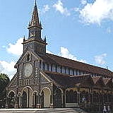
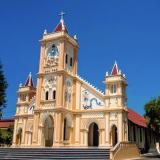
Nha thu Chanh toa Kon Tum or Saint Mary's Cathedral of Kon Tum, also known as Nha Thu Gu— Kon Tum, is located in the center of Kon Tum city, Kon Tum province, in the southwestern part of Vietnam, near the borders with Laos and Cambodia. It is one of the notable landmarks in Kon Tum, a province in Vietnam.
Chua Bac ai, located in Kon Tum city, the capital of Kon Tum province, in the central highlands of Vietnam, is also known as Bac ai Pagoda. Chua Bac ai has ahistory dating back several decades. It is a Buddhist temple and place of worship for the local Buddhist community.
Ngaba Dong Duong, also known as Indochina Triple Intersection or Dong Duong Crossroads, is located in the Nguc Hoi district, which is part of Kon Tum province in the central highlands of Vietnam. It serves as atransportation hub for travelers moving through the region.
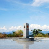
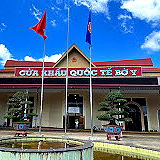
Cuakhau Bu Y, also known as Bo Y Border Crossing or simply Bo Y Border Gate, is aborder crossing point located in the Nguc Hoi district of Kon Tum province, which is in the central highlands region of Vietnam.
Kon Tum province lies in the Central Highlands region of Vietnam and shares borders with Laos and Cambodia. It has an area of 9,934 square km and a population of approximately 530,000. The economy is primarily agricultural.