
|
Union Valley Reservoir Camping California Last Updated: 06/20/2025 |
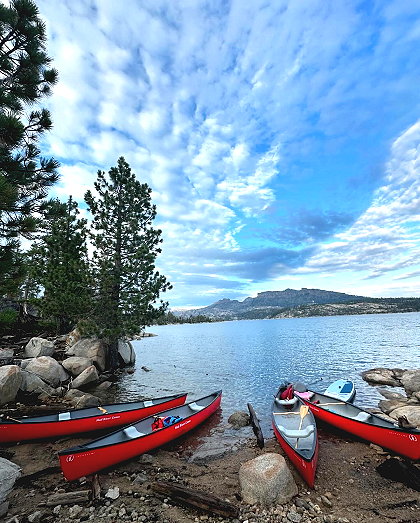
| Union Valley Reservoir campgrounds are at about 4,900 feet in elevation and are usually open from Memorial Day weekend through late September. Single sites are limited to 1 vehicle and 6 people. An extra vehicle is allowed for an additional fee if parking space permits. Trailers are counted as vehicles. | |
| Union Valley Reservoir is about 15 miles north of Highway 50 on Ice House Road. All types of boating and watersports are allowed in the lake, including jet skis and waterskiing. The Union Valley Bike Trail connects many of the campgrounds. | |
Website Wikipedia
El Dorado County » Edr
Place » Outdoors

|
Round Lake Place » Outdoors Round Lake in El Dorado County, California, is a scenic natural area accessible via the Tahoe Rim Trail, located near the Big Meadow trailhead on Highway 89 towards Luther Pass. The hike to Round Lake is considered moderate, starting with a steep, switchback climb followed by easier terrain through Big Meadow. 205 views 💖 1 👍 0California |
|
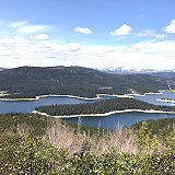
Union Valley Reservoir Place » Outdoors Union Valley Reservoir is a reservoir in eastern El Dorado County, California, about 20 miles (32 km) northeast of Placerville. The 277,000 acre-feet (342,000,000 m3) lake is in Eldorado National Forest in the Sierra Nevada at an elevation of 4,870 feet (1,480 m). 208 views 💖 1 👍 0California |
|
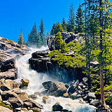
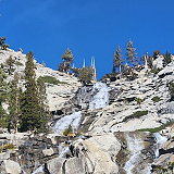
Bassi Falls Place » Outdoors Bassi Falls is a picturesque waterfall located in the El Dorado National Forest, near the community of Kyburz, in El Dorado County, California. It is nestled in the Sierra Nevada Mountains, approximately 50 miles east of Sacramento. 187 views 💖 1 👍 0El Dorado County, California |
|
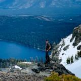
Mount Tallac Place » Outdoors Mount Tallac is a mountain located in the Sierra Nevada range of California, United States. It is situated in the Desolation Wilderness and stands at an elevation of 9,735 feet (2,967 meters). Mount Tallac is a popular destination for hiking, with several trails leading to the summit. 362 views 💖 1 👍 0El Dorado County, California |
|
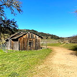
Cronan Ranch Park Place » Outdoors Cronan Ranch Regional Trails Park, located in Pilot Hill, California, encompasses approximately 1,418 acres of scenic landscapes, including rolling hills, oak woodlands, and riverfront areas along the South Fork of the American River. The park offers over 12 miles of multi-use trails suitable for hiking, mountain biking, horseback riding, fishing, and bird watching. 158 views 💖 1 👍 0Pilot Hill, CA 95664 |
|
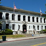
El Dorado County Place » City El Dorado County is a county located in the Sierra Nevada region of Northern California. It is bordered by several counties, including Sacramento County to the west, Amador County to the north, Alpine County to the northeast, Douglas County in Nevada to the east, and Placer County to the south. As of the 2020 census, the population was 191,185. 332 views 💖 1 👍 0California |
|
Pyramid Creek Trailhead Place » Outdoors Pyramid Creek trailhead is located off U.S. Route 50 a couple miles east of Strawberry, California, west of Echo Pass. This trailhead offers a commonly accepted route to the summit of Pyramid Peak, although the most popular trailhead to Pyramid Peak is an unmarked trailhead at Rocky Canyon which is about a mile west of the Pyramid Creek Trailhead. 192 views 💖 1 👍 017479 Lincoln Hwy, Twin Bridges, CA 95735 |