
|
Mount Tallac El Dorado County, California Last Updated: 01/02/2025 |
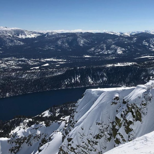
| Mount Tallac is a mountain located in the Sierra Nevada range of California, United States. It is situated in the Desolation Wilderness and stands at an elevation of 9,735 feet (2,967 meters). Mount Tallac is a popular destination for hiking, with several trails leading to the summit. | |
| The most common route is the Mount Tallac Trail, which starts at the trailhead near the end of Fallen Leaf Lake Road in South Lake Tahoe. The trail is approximately 10.2 miles (16.4 km) round trip and gains about 3,500 feet (1,070 meters) in elevation. The hike is considered strenuous and requires a good level of fitness, but the views from the summit are worth the effort. Hikers can see Lake Tahoe, Fallen Leaf Lake, and the surrounding mountain ranges from the top. In the winter, Mount Tallac is a popular destination for backcountry skiing and snowboarding. However, it is important to be prepared for the cold and snowy conditions, as well as the potential avalanche hazards in the area. | |
El Dorado County » Edr
Place » Outdoors

|
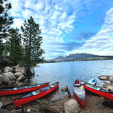
Round Lake Place » Outdoors Round Lake in El Dorado County, California, is a scenic natural area accessible via the Tahoe Rim Trail, located near the Big Meadow trailhead on Highway 89 towards Luther Pass. The hike to Round Lake is considered moderate, starting with a steep, switchback climb followed by easier terrain through Big Meadow. 207 views 💖 1 👍 0California |
|
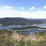
Union Valley Reservoir Place » Outdoors Union Valley Reservoir is a reservoir in eastern El Dorado County, California, about 20 miles (32 km) northeast of Placerville. The 277,000 acre-feet (342,000,000 m3) lake is in Eldorado National Forest in the Sierra Nevada at an elevation of 4,870 feet (1,480 m). 209 views 💖 1 👍 0California |
|
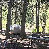
Union Valley Reservoir Camping Place » Outdoors Union Valley Reservoir campgrounds are at about 4,900 feet in elevation and are usually open from Memorial Day weekend through late September. Single sites are limited to 1 vehicle and 6 people. An extra vehicle is allowed for an additional fee if parking space permits. Trailers are counted as vehicles. 193 views 💖 1 👍 0California |
|
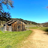
Cronan Ranch Park Place » Outdoors Cronan Ranch Regional Trails Park, located in Pilot Hill, California, encompasses approximately 1,418 acres of scenic landscapes, including rolling hills, oak woodlands, and riverfront areas along the South Fork of the American River. The park offers over 12 miles of multi-use trails suitable for hiking, mountain biking, horseback riding, fishing, and bird watching. 160 views 💖 1 👍 0Pilot Hill, CA 95664 |
|
El Dorado County Place » City El Dorado County is a county located in the Sierra Nevada region of Northern California. It is bordered by several counties, including Sacramento County to the west, Amador County to the north, Alpine County to the northeast, Douglas County in Nevada to the east, and Placer County to the south. As of the 2020 census, the population was 191,185. 334 views 💖 1 👍 0California |
|
Middle Fork Cosumnes Campground Place » Outdoors Middle Fork Cosumnes Campground is a campground located in El Dorado County, California, United States. It is situated along the Middle Fork of the Cosumnes River, which offers opportunities for fishing, swimming, and other water activities. The campground is surrounded by scenic forests and hills, providing a peaceful and relaxing atmosphere for camping. 216 views 💖 1 👍 0Grizzly Flats, CA 95636 |
|
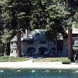
Vikingsholm Place » Outdoors Vikingsholm is a historic mansion located in Tahoma, California, on the shore of Emerald Bay of Lake Tahoe. It was built in 1929 as a summer home for Lora Knight, a wealthy philanthropist and preservationist who was inspired by Scandinavian architecture. The mansion was designed by architect William Henry Weeks, and its construction took 200 workers and two years to complete. 766 views 💖 4 👍 0California 89, Tahoma, CA 96142 |