
|
Colusa County California ☎ +1 530-458-0508 Last Updated: 08/31/2024 |
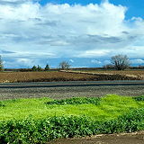
| Colusa County is a county located in the U.S. state of California. As of the 2020 census, the population was 21,839. The county seat is Colusa. It is in the northern Sacramento Valley, northwest of the state capital, Sacramento. Colusa County has many different types of attractions to offer residents and visitors. | |
Website Wikipedia Facebook
Colusa County » Cls
Place » City
|
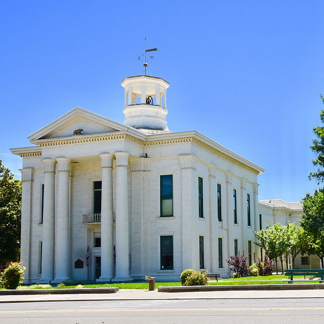
Colusa Place » City Colusa is a city in Colusa County, California, located in the Sacramento Valley region of Northern California. The city has a population of approximately 5,971 people (as of the 2020 census). It is the county seat of Colusa County and serves as a hub for agricultural activity in the surrounding area. 233 views 💖 1 👍 0California |
|
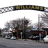
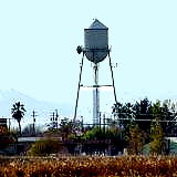
Williams Place » City Williams is a city located in Colusa County, California, United States. It has a population of approximately 5,200 people and covers an area of 5.4 square miles. Williams is situated in the Sacramento Valley, about 60 miles north of Sacramento and 40 miles south of Redding. 229 views 💖 1 👍 0California |

|
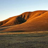
Stonyford Place » City Stonyford is a census-designated place in Colusa County, California. It lies at an elevation of 1184 feet (361 m). Stonyford's population was 149 at the 2010 census. Stonyford is a ranching community. Beautifully sited in a mountain plateau approximately 1200 feet above sea level, it provides entry to the adjoining East Park Reservoir and Mendocino National Forest. 229 views 💖 1 👍 0California |
|
Arbuckle Place » City Arbuckle is a census-designated place in Colusa County, California. The population was 3,484 at the 2020 census, up from 3,028 at the 2010 census. Arbuckle is situated in the southerly portion of Colusa County, approximately 20 miles (32 km) southwest of the City of Colusa, the county seat. 206 views 💖 1 👍 0California |
|
Sites Place » City Sites is an unincorporated community in Colusa County, California, United States. It lies at an elevation of 299 feet (91 m). Western Colusa County, Sites is a hamlet tucked into the folds of the Coast Range mountains about nine miles west of Maxwell on the way to Lodoga. Its population is 17-20. 211 views 💖 1 👍 0California |
|
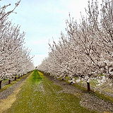
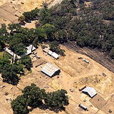
Maxwell Place » City Maxwell is a census-designated place and farm community in Colusa County, California. It lies at an elevation of 92 feet (28 m). The main crop grown is rice, though a variety of others such as grapes, almonds, olives, squash, and sunflowers are grown as well. Maxwell's population was 1,103 at the 2010 census. 198 views 💖 1 👍 0California |
|
Leesville Place » City Leesville is an unincorporated community in Colusa County, California. It lies at an elevation of 1434 feet (437 m). This village is situated at the head of Bear Valley and is distant in a due west line twenty-five miles from Colusa. 213 views 💖 1 👍 0California |

|
Lodoga Place » City Lodoga is a census-designated place in Colusa County, California. It lies at an elevation of 1237 feet (377 m). Lodoga's population was 184 at the 2020 census. Located in the northern part of the state, it is situated near the eastern foothills of the Coast Range. The area is primarily rural and known for its scenic landscapes, including rolling hills and oak woodlands. 194 views 💖 1 👍 0California |
|
Delevan Place » City Delevan is an unincorporated community in Colusa County, California, 3.5 miles (5.6 km) south of Norman and 5 miles (8.0 km) north of Maxwell. It lies at an elevation of 92 feet (28 m). As of 2016, Delevan had a population of 70. 194 views 💖 1 👍 0California |

|
Grimes Place » City Grimes is a census-designated place in Colusa County, California on the Southern Pacific Railroad. It lies at an elevation of 46 feet (14 m). Grimes's population was 391 at the 2020 census. 199 views 💖 1 👍 0California |